


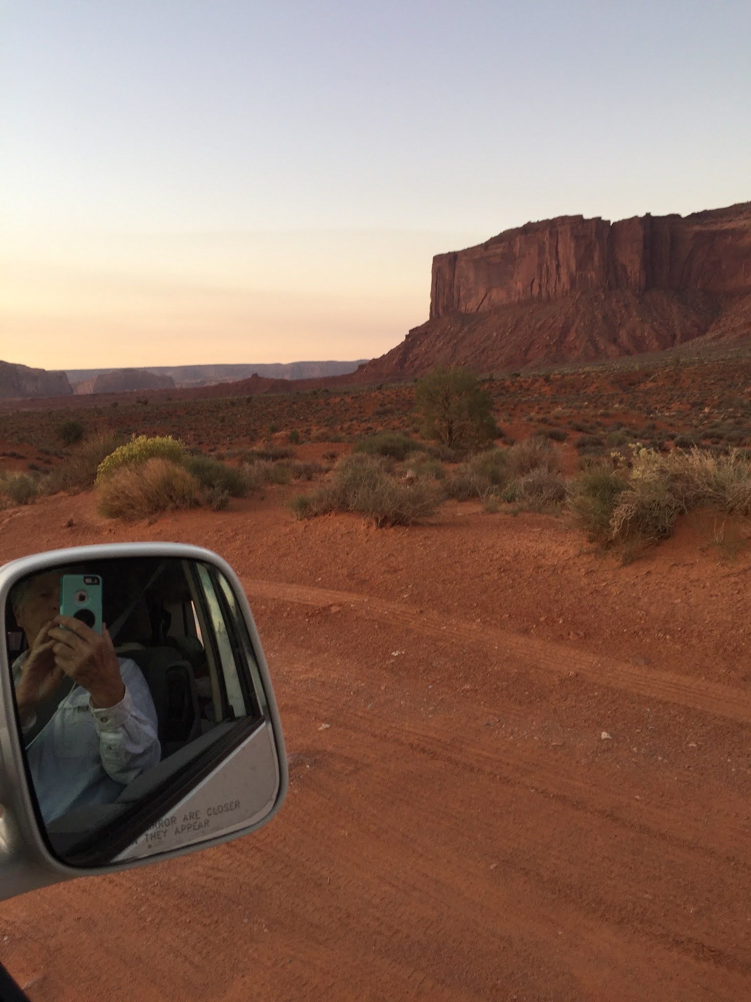
 And then we would go around a bend in the dirt road, and the view would change. Like this.
 And then a new vista would appear, with the sun climbing slowly everything changed every minute.
 I suspect this photo is out of sequence, as it looks a lot like the moonrise the evening before.
 And then we would have to take pictures of each other just to prove we were there.
 The scale of the monuments is such that you hardly have time to consider the geological changes that took place over millions of years.
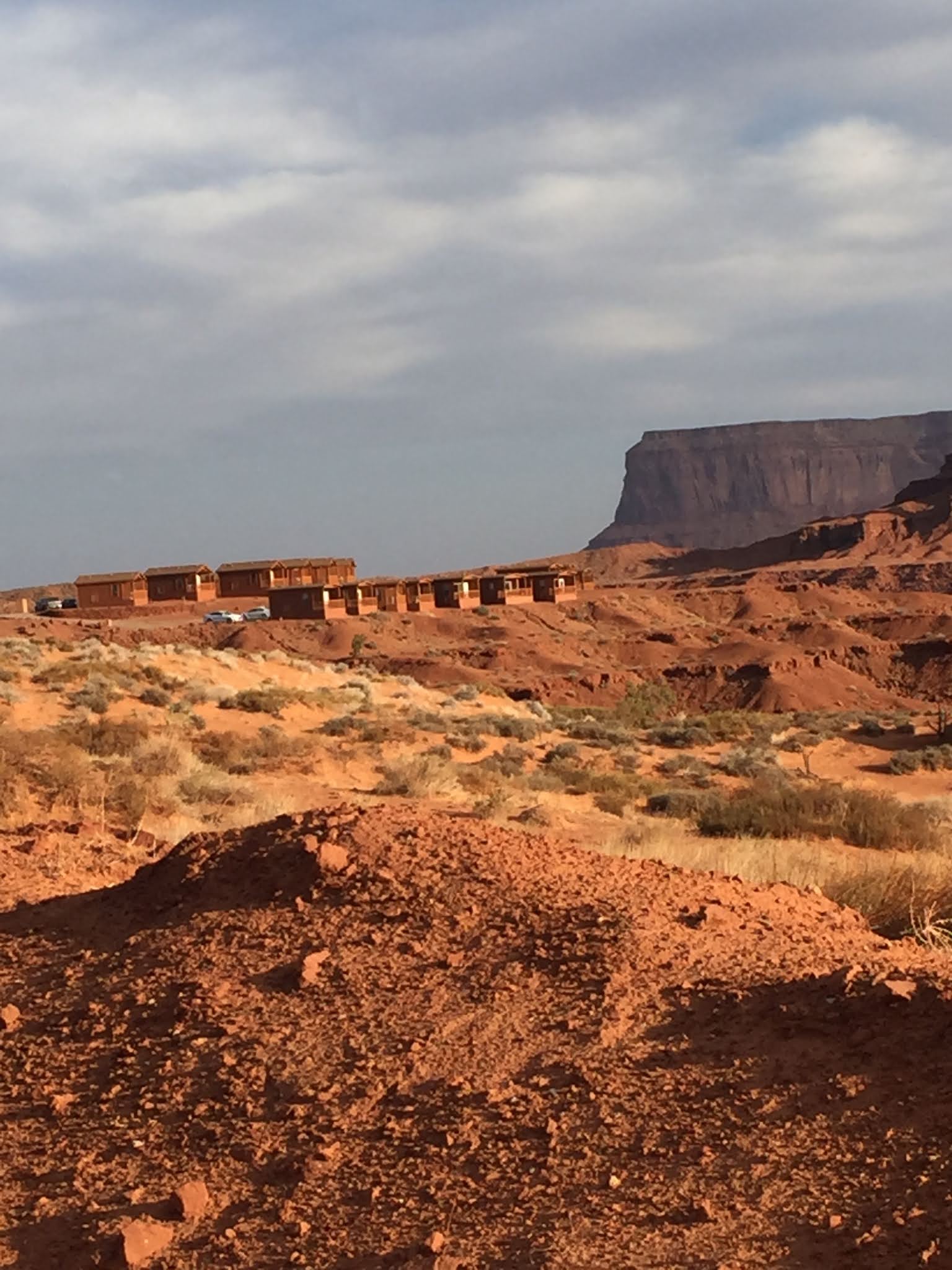
 Whether far away.....
 Or nearby.
 When we finished the drive through the Monuments, we went back up to the Visitor Center atop the ridge looking east. The information center was closed, but the gift shop was open. It proved to be a good stop. Everything they offer is carefully labled, and one entire section is devoted to native-made items, from large expensive pottery to small souvenirs. They had a lot of Navajo silver and jade jewelry, not something we collect, but we could admire the workmanship.
 One more view from the ridge looking east.
 The Navajo people, who call themselves "Dine'", have done an excellent job protecting and sharing this national treasure. They not only manage the resort and visitor experiences, they also live in the valley among all this beauty. Side roads, marked "private" lead off to small ranches and homes and hogans tucked in among the towers. A few horses and sheep are always visible, and you can get a feel for what it is like for people who have lived here for hundreds or thousands of years.
The people we encountered were friendly and helpful. The best example was when we had trouble with a tire, and were considering calling AAA from a town 100 miles away. At the trading post gas station, the air pump was broken and they said there was no help anywhere nearby.
But a shop keeper in the native market told us about a local man who had a tire shop, and gave us directions. In this area, the directions were to go along the road past the commercial RV park, expect the road to be narrow and maybe dirt, but look for a home off to the right with tires stacked outside a small wooden garage. We pulled into the yard, and the man stopped what he was doing, helped us immediately, and fixed the problem.
The Navajo people, who call themselves "Dine'", have done an excellent job protecting and sharing this national treasure. They not only manage the resort and visitor experiences, they also live in the valley among all this beauty. Side roads, marked "private" lead off to small ranches and homes and hogans tucked in among the towers. A few horses and sheep are always visible, and you can get a feel for what it is like for people who have lived here for hundreds or thousands of years.
The people we encountered were friendly and helpful. The best example was when we had trouble with a tire, and were considering calling AAA from a town 100 miles away. At the trading post gas station, the air pump was broken and they said there was no help anywhere nearby.
But a shop keeper in the native market told us about a local man who had a tire shop, and gave us directions. In this area, the directions were to go along the road past the commercial RV park, expect the road to be narrow and maybe dirt, but look for a home off to the right with tires stacked outside a small wooden garage. We pulled into the yard, and the man stopped what he was doing, helped us immediately, and fixed the problem.
 And so, as the old travelogue movies used to say, we bid farewell to the incredible Monument Valley.
Day Five began on the road from Great Basin National Park in Nevada, driving east across Utah and then south through Moab and on to Blanding, a small town in the middle of some of the prettiest country you will ever see. And it ended in the stupendous collosal Monument Valley
To get there we started east along Highway 50, joined Interstate 70, and then turned south on 191.
The western side of Utah starts out in dry brushy rolling hills, then comes into large dry valleys and finally through farming towns like Hinkley, where we finally saw some green, and through the little farm town Delta. Breakfast in the cafe there included a conversation overheard that ranged from the Mormon church leadership's recent pro-mask announcement for Covid prevention, to one farmer telling another to never quit his job working for someone. Let them fire you, and you can either collect benefits or sue, he said.
Very few people in rural Utah towns wear masks.
(Note: I read that every town and county in Utah except Salt Lake City has a large majority of Mormons in residence, including places like Hinkley and Delta. Probably true, but for they seem to have the same concerns, manners and politics as almost any other rural areas.)
A word about the Interstate 70 route across Utah. It has to be one of the most beautiful stretches of Interstate Highway in the nation .
Hidden back in the canyons are miles of off-road trails, and you can see evidence in hundreds of off-road vehicles with roll-bar cages and open sides at a scattering of towns and trailer parks. The roads follow the old Pony Express route, and some places brag about that brief moment in Western history. Mostly it is seen through a series of "historical markers," several pointing out that just over the hills the intruding pony riders encountered hostility from the natives.
Also off the road a few miles are major fossil sites, where dinosaur bones can be seen if your vehicle can handle the back roads.
Once we left the Interstate highway, where the speed limit was 80 mph, traffic slowed slightly as we drove south by Arches National Park where cars were backed up waiting to get in, through Moab which is always jammed with tourists and four-wheeled contraptions of every kind.
We landed for a couple of nights at an older motel in Blanding, Utah, just north of the Navajo Reservation and near Bear's Ears National Monument,
Blanding is a comfortable town, with a large Native American population and a couple of good places to eat, and a laundromat where we refreshed our limited clean clothes.
We discovered a wonderful museum at the Edge of the Cedars State park, right on the edge of town. The park has an excavated pueblo dwelling site, complete with kiva, but it was the collection inside that was so fascinating. They had Anasazi pottery and basketry, some items a thousand years old, and all found nearby, all of them very rare. The displays contained a lot of information, interestingly presented. It is a must-see museum if you travel that way.
 |
| Pat taking in some of the upper floor exhibits. |
 |
| A native flute, a woven water jug and what have been children's arrows. |
 |
| And Kiva to explore. |
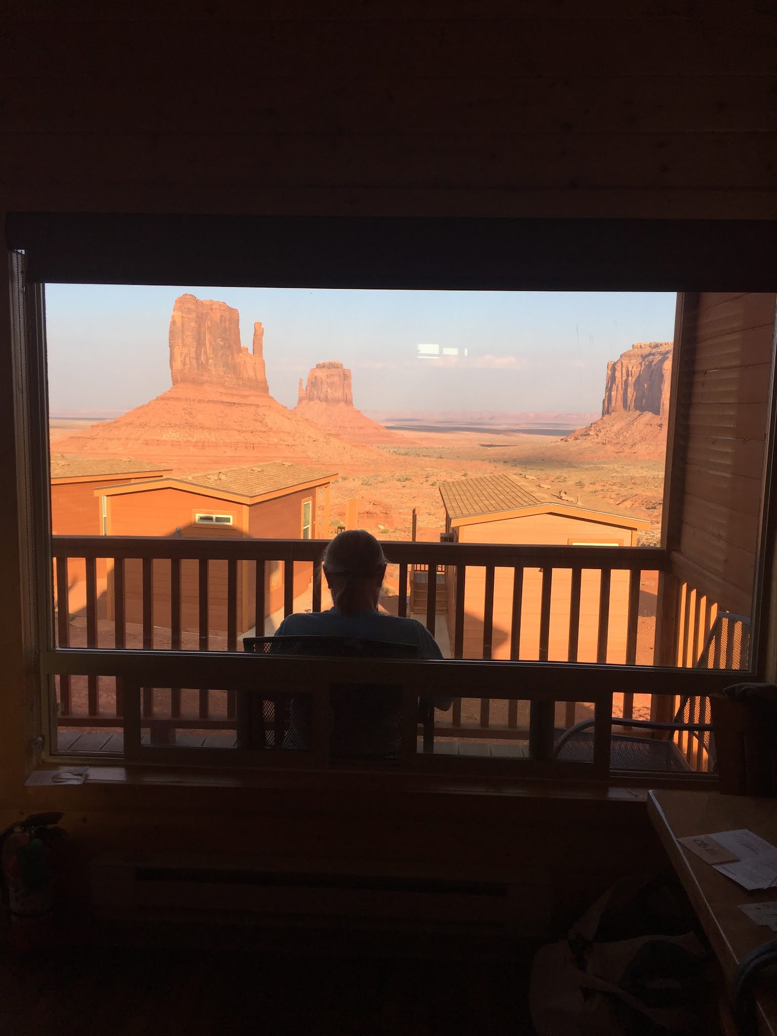
We ended the day at our cabin at Monument Valley. The Navajo Nation's Monument Valley. It looks and feels like a national park, but is located on and run very well by the Navajo Nation. The series of photos below are all from our first afternoon. We arrived too early to check into our cabin or take the long car tour through the valley so we rode around, checking out Goulding's Trading Post a few miles away, the only open place to eat, a gas station and the gift shop. The pictures are mixed due to editing problems but you can tell that once we got into our cabin we were more than happy with the view right out the front window. The cabins are located on two rows, ours in the back but at a higher elevation, so every cabin has the spectacular view of the Valley spread out below. The giant monuments, buttes and mesas, dominate everything. At the time it was sunset so the colors were even more fantastic. The "resort" is called "The View" and is operated by the Navajo. Normally it has everything you would need: hotel, cabins, RV park, Visitor Center, a choice of tours (guided or not)cafe and gift shop. Due to Covid the only things open were the tours, gift shop, hotel and cabins. The cabins where we stayed are modern and clean, have a refrigerator and microwave, good beds, and a tiny extra room with two extra (bunk) beds. It is not cheap (about $200 a day) but you get a thousand dollar view plus comfort.


We traveled five Western states in two weeks starting at our California home and going across back roads in Nevada and Utah, and looping through Arizona and Colorado.
We did not have a precise plan, just a vague destination, and that worked out very well. This was a road trip: part camping, lots of driving, and part resting in places along the way.
There is beauty to be found everywhere. But the highlights were the Navajo's Monument Valley, Arches National Park, Great Basin National Park, the southern end of the Rockies at Durango, plus miles and miles of beautiful open country across Utah and Nevada. Lots of geology everywhere.
A few basics:
--We traveled in "Snowflake," our 2002 Volkswagen Eurovan. and the odometer passed 100,000 miles during the trip. A few times the speedometer went over 80 mph. We averaged about 20 miles per gallon.
--We were on the road 14 days.
--We camped in our van seven days, stayed in a cabin for two, and spent four nights in motels.
Our route took us from home in Murphys, Ca., across Ebbetts Pass into Nevada, and then south through Moab, Utah to Monument Valley on the Arizona line. From there we drove into Colorado, and then homeward along essentially the same path.
The Covid pandemic effect was everywhere, but we were cautious, wore our masks, and honored the businesses and sites that took it seriously.
What follows is a day-by-day log and where we were and what we saw.
Days 1 and 2
We pulled out of our driveway in Murphys on a Monday morning fortified with coffee, drove east across Highway 4 (Ebbetts Pass Scenic Highway-- elevation over 9,000 feet), through the town of Markleeville and on into the high plains of Nevada.
Across Nevada we avoided Interstates and traveled the "loneliest highway" -- US 50 -- which runs due east from Carson City. It isn't really all that lonely, but traffic and towns are sparse and even in a Volkswagen van you can cruise along at 75 and make good time.

Once you leave the high plains of western Nevada, where wild horses really do roam alongside the highways, you come into a widely spaced series of old mining towns in the mountains. Before you get there you pass through Fallon, a town that proclaims itself an "oasis," and is fueled by military installations scattered throughout the desert. There is a Naval Air Station (think "Top Gun" stuff), a bombing range, and even the site of underground nuclear test sites. One suspects a lot of UFO sitings happen nearby.
At the mining towns you can sometimes find breakfast, but sometimes everything seems closed down. Even the Owl Casino and Cafe was closed, along with everything else, when we passed through Eureka.

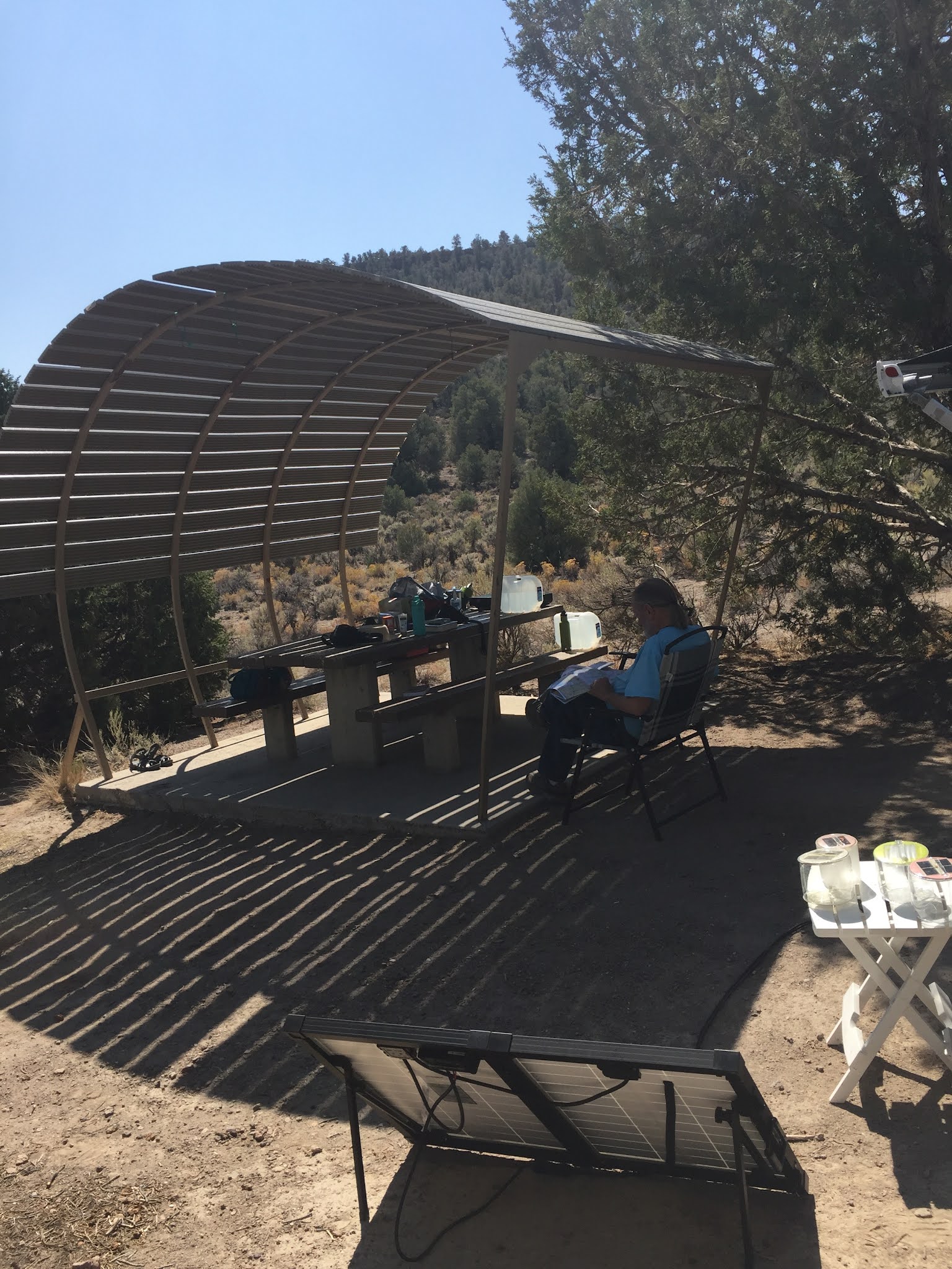
We stopped for the night, as planned, at a beautiful campsite at the Hickison Petroglyphs near Austin, a site managed by the Bureau of Land Management. There are only 16 sites, but the campground is rarely full unless it is time for local native Americans to collect pine nuts -- a local tradition.


The view of the high desert was better than my photo.
We stayed there two nights, just because we could, taking short walks, overlooking high desert and listening for coyotes at night.
The petroglyphs are along a short trail adjacent to the campground, with symbols and carvings chipped into the canyon walls.
 |
| Pat checking the Petroglyphs. |
It is a nice quiet spot to stay, but it is "dry" camping: clean pit toilets, but no water or electricity. But we had a quiet well-designed campsite with a shelter, picnic table and a fire pit. (Because of the fire season we did not have a campfire anywhere during the trip.)
As a place to camp, without urban amenities, I give it five stars.
Day 3 and 4: We had an early breakfast at Ely, Nevada, landed later at Big Basin National Park, almost into Utah, one of the few western national parks we had never seen.
It is a beautiful park, reaching from the desert basins to the peak of the mountains. A major feature of the park is a large cave, where tours are booked well ahead, so we missed that. (The Visitor Center gave us an introduction.)


Next: On to Utah and Monument Valley
